


Visualizing the Powerful, Unnamed Storm that Battered Southeast North Carolina
Last week’s historic rainfall and flooding in coastal North Carolina provided a reality check that severe weather is becoming increasingly normalized in our communities. The system, identified as Potential Tropical Cyclone Eight back on September 15, didn’t get the national media attention of a named storm, but it still brought major damage, disruption, and downpour, including a deluge of 12 to 20 inches (300 to 510mm) over 12 hours for a 25-mile-wide (40km-wide) area between Carolina Beach and Columbus City.
Southeast North Carolina is an example of an area where changes in weather patterns and floodplains are causing an increased risk for destructive floods. This September’s storm – classified as a once-in-a-thousand-years flood – was the fifth “once-in-a-lifetime” flood to affect the region over the last 25 years.
Visualizing Potential Tropical Cyclone Eight
Here’s a snapshot from our sister brand Earth Networks’ Sferic Maps® lightning detection and storm tracking app that was captured just before noon on Monday, September 16 as the system pummeled the coastline near Carolina Beach.

The area in red represents the most intense area of the storm, which ultimately cut a damaging path several hundred miles inland in what some have called a “fire hose” effect. The purple arrows represent lightning strikes. The numbers inside the red shapes are real-time wind speeds (expressed in miles per hour), with a vector arrow showing their direction.
As the imagery from Sferic Maps illustrates, this storm still packed a wallop, even though it doesn’t look like a major tropical storm. The winds aren’t nearly intense enough, and they never packaged the storm into the characteristic shape of a serious tropical cyclone – but the system still picked up energy from warm coastal waters before making landfall in a way that ultimately did look like a small hurricane, as this map from the National Weather Service shows:

To understand the true human impact of Potential Tropical Cyclone Eight, it’s essential to get down to ground level. The storm wreaked havoc on roads throughout the region. In Carolina Beach, flash flooding made roadways impassible and filled parked cars with water, as these local reporters shared on X:
WOW! Everyone is safe! Insane flooding in Carolina Beach in North Carolina. Video by Nave Eyp pic.twitter.com/U7lUVjIBun— Kaitlin Wright (@wxkaitlin) September 16, 2024
Wild #flashflood ongoing in #carolinabeach and around SE #NorthCarolina #PTC8 @NWSWilmingtonNC pic.twitter.com/PeYsXqTRWW
— Jonathan Petramala (@jpetramala) September 16, 2024
Throughout Brunswick County, the flooding created major road washouts. Monday into Tuesday, both main routes to the Wilmington area were closed due to water damage, putting travelers in major danger and partially cutting off the coastal communities as the event played out. Statewide, 52 roads were closed across 12 counties. Regrettably, one citizen died driving into flood waters.
There have been major road washouts across Brunswick County due to today's heavy rainfall and flash flooding. Never drive around barricades! Additional details are available from the Brunswick County Sheriff's Office at https://t.co/JYyf04LTC8 #ncwx pic.twitter.com/CjG4aWA0Ej— NWS Wilmington, NC (@NWSWilmingtonNC) September 16, 2024
At the end of the work week, on September 20, there were still at least 20 storm-related road closures across the county. Each “Weather Event” marker on the map below from the North Carolina Department of Transportation represents an area of road that remains closed or impassible due to damage from Potential Tropical Cyclone Eight.

All in all, it’s estimated Potential Tropical Cyclone Eight will have a $7 billion impact on North Carolina. Much of that cost is associated with the extensive damage to roads, bridges, and other highway infrastructure across the southeast North Carolina region. Recovery costs for businesses, homes, and vehicles may still be under-reported as citizens and insurance companies continue to assess damage.
How the Davis WeatherLink community weathered the storm
More than 100 members of Davis' WeatherLink network are based in the area impacted by Potential Tropical Cyclone Eight. We sincerely hope that every single one of them is physically safe and that their homes, businesses, and communities were spared from any major losses.
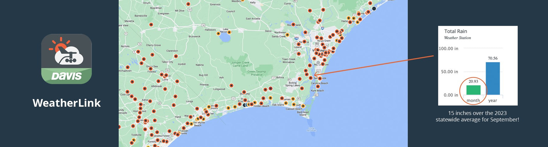
One station just outside Wilmington was reporting a monthly total of nearly 21 inches (533mm) of rain on Tuesday afternoon after showing less than two inches (50mm) before the storm began.

Another WeatherLink user even captured this video of flooding in his Oak Island neighborhood, showing heavily flooded back yards and overflowing swimming pools (along with his Vantage Pro2 weather station, which reported accurate data throughout the event, even as flood waters rose around it).
Potential Tropical Cyclone Eight has many important lessons to teach as we continue to navigate this era of more frequent historic storms. A tropical system doesn't need to be named to be historic. We need to improve the condition of infrastructure in coastal areas. And most importantly of all, this event shows why it's so important for every level of our communities -- from everyday citizens to government and business leaders -- to think about severe weather preparedness and collaborative resilience.
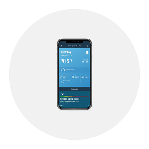
If you’re fascinated by weather stories like this one, you need to join the WeatherLink community today! The WeatherLink desktop and mobile application connects you with real-time data from a global network of more than 72,000 Davis weather stations, so you can get an authentic ground-level understanding of weather in your backyard or around the world. If you're looking for a station of your own to increase weather intelligence in your area, we can help with that too.

![]()
In the face of escalating environmental risks, AEM is the essential source for insights on weather, climate, lightning, floods, wildfires, water management, and more.
Learn more about AEM and all of our solutions here.